Geography & Climate
Between the Western Ghats and the Arabian Sea.
Kundapura lies on the narrow, fertile coastal plain of western Karnataka, hemmed between the wall of the Western Ghats to the east and the Arabian Sea to the west. It is a landscape defined by water (tidal rivers, backwaters, estuaries, golden beaches and one of India's heaviest monsoons) and is among the most distinctive coastal settings in the country, with rivers wrapping the town on three sides.
Location & setting
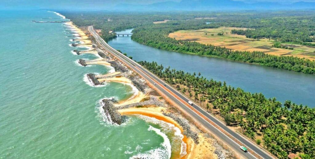
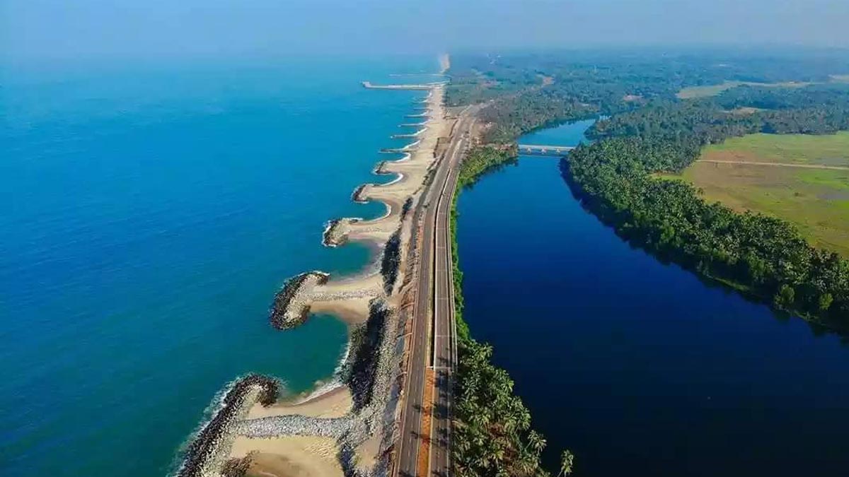
The town sits at roughly 13.6° N on the coast of Udupi district, about 38 km north of Udupi and some 91 km north of Mangaluru, on National Highway 66 and the Konkan Railway. The coastal plain here is only a few kilometres wide before the land rises sharply into the Ghats; the town itself stands almost at sea level on the estuary, ringed by the Panchagangavalli river to the north, the Kalaghar river to the east, and backwaters and the sea to the west, leaving only the south connected by land.
Rivers & estuary
Main article: Rivers and Backwaters
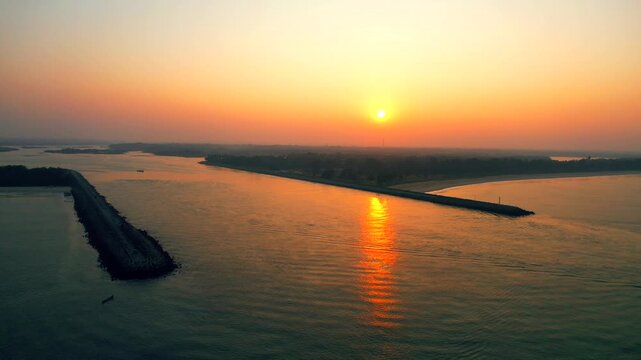
Kundapura's defining feature is the Panchagangavalli ("five Ganges"), the wide estuary where five rivers, the Varahi, Kedaka, Chakra, Kubja and Souparnika, drain into the sea near Gangolli. These rivers descend from the Ghats and create a maze of backwaters, mangroves and small islands. The most celebrated stretch is at Maravanthe, where the Souparnika runs so close to the shore that the highway threads along a thin strip with the river on one side and the open sea on the other.
Coast & beaches
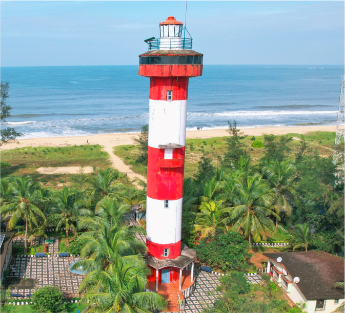
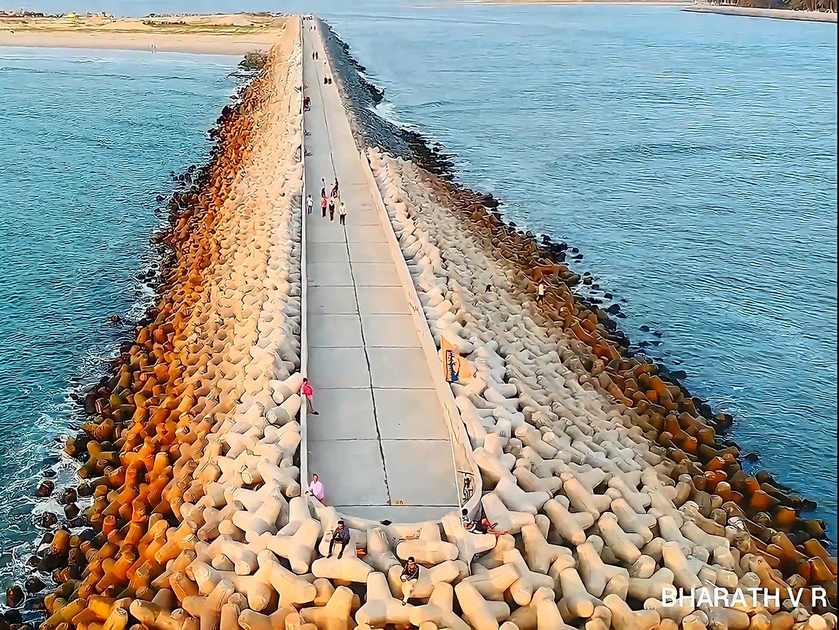
The shoreline is broad, golden and largely unspoiled. Beyond Maravanthe lie quiet beaches such as Trasi and the estuary beach of Kodi Bengre, where the river meets the sea among mangroves and the Kundapura lighthouse marks the river mouth. Engineered breakwaters, the sea walks at Gangolli and Kodi, reach out into the surf and have become favourite vantage points for watching the sunset.
Terrain & soils
The plain is covered with paddy fields, coconut and areca groves, and patches of laterite. The red laterite soils and alluvial river deposits support intensive cultivation, and agriculture has long been the backbone of the rural economy. Inland, the land climbs quickly into the dense evergreen forest of the Ghats, part of a UNESCO-recognised global biodiversity hotspot that feeds the rivers and shelters elephants, leopards and rich birdlife.
Climate
Kundapura has a tropical monsoon climate. The southwest monsoon (June–September) is extremely heavy, frequently delivering more than 4,000 mm of rain a year, swelling the rivers into powerful flows and cloaking the Ghats in cloud. October to February is warm, lush and relatively dry, the comfortable peak season for visitors. March to May is hot and humid. The sea moderates temperatures year-round, so extremes are rare even in summer.
| Season | Months | Character |
|---|---|---|
| Southwest monsoon | Jun–Sep | Very heavy rain; rivers in spate; the Ghats at their greenest |
| Post-monsoon & winter | Oct–Feb | Warm days, mild nights, low rain, the best time to visit |
| Summer | Mar–May | Hot and humid, tempered by the sea breeze |
The monsoon is the great organising fact of life on this coast, shaping the farming calendar, the fishing season and the rhythm of festivals.
See also
References & notes
- Compiled guide: "Kundapura, The Pearl of Coastal Karnataka".
- India Meteorological Department, coastal Karnataka rainfall data.
- Udupi District statistical handbook.
Photographs were contributed by residents and visitors and are used for cultural and educational reference.